24/7 water damage help in Murrieta, CA | Serving 92562 & 92563

24/7 water damage help in Murrieta, CA | Serving 92562 & 92563
Flood guide
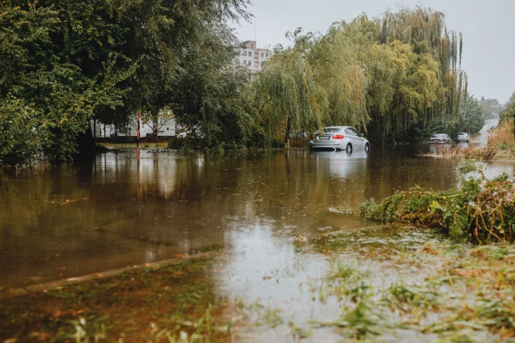
Most of the year Murrieta is dry, but a few heavy winter storms can send Murrieta Creek over its banks, close low roads and push water into homes. This guide covers where the city floods, what your FEMA flood zone means, how flood insurance works and what to do if water gets inside. If it already has, Murrieta Flood Damage handles flood cleanup across Murrieta’s 92562 and 92563 ZIP codes, 24 hours a day.
How can we help?
We answer 24 hours a day, 7 days a week.
Flood areas
Safety tip
Never drive or walk through a flooded road. Moving water can sweep away a car, and floodwater can hide washed-out pavement.
The creek runs about 13 miles from Wildomar through the west side of Murrieta, past Historic Downtown, to Temecula, where it joins Temecula Creek to form the Santa Margarita River. It drains more than 220 square miles, so a big storm in the hills reaches the channel fast.
A tributary on the east side of the city that rises in the Domenigoni Valley and flows into Murrieta Creek, passing the Murrieta Hot Springs area on the way.
The City has warned of closures on Kalmia Street between 2nd Street and Hayes Avenue and on Briggs Road between Los Alamos and Porth Road, with flood signs on Murrieta Hot Springs Road and along Murrieta Creek.
Away from the creeks, flooding usually comes from heavy runoff off hillsides and streets that overwhelms yards, driveways and storm drains and flows under doors.
History
Damaging floods in 1938 led Riverside County to build sections of the creek channel the following year.
Days of heavy rain sent Murrieta Creek over its banks, flooding homes and businesses on the west sides of Murrieta and Wildomar and in Old Town Temecula.
The U.S. Army Corps of Engineers and the Riverside County Flood Control and Water Conservation District are widening the channel and adding a flood control basin to give 100-year flood protection.
The latest phase began construction in September 2025, with overall completion expected in fall 2028.
Flood zones
A Special Flood Hazard Area with at least a 1% chance of flooding in any year, the "100-year flood zone." FEMA maps show a base flood elevation here. If you have a federally backed mortgage, flood insurance is required.
Outside the high-risk area. Flood insurance isn't required, but flooding still happens here, especially from heavy runoff.
Enter your address on FEMA's Flood Map Service Center to see your zone. Zones AE and X are the most common in Murrieta. Your lender or insurance agent can also tell you which zone your home is in.
Insurance
Standard homeowners and renters policies don’t cover water that comes in from outside at ground level. That takes a separate flood policy through the National Flood Insurance Program (NFIP) or a private insurer.
FEMA estimates that just one inch of water can cause $25,000 in damage to a home.
A new NFIP policy usually has a 30-day waiting period before it takes effect, so buying one when a storm is forecast is too late.
Building and contents coverage are separate, so check that your policy includes both.
Be ready
In past storms the City has offered sand and sandbags at Fire Station 1 (41825 Juniper Street), Fire Station 2 (40060 California Oaks Road) and the Municipal Services yard at Fig Street and Jefferson Avenue. Check City announcements for current locations.
Right away
01
Keep out of standing water near outlets or appliances. Shut off power at the breaker only if you can reach it without standing in water.
02
Take photos and video of the water, the rooms and damaged belongings before anything is moved.
03
Floodwater from outside is treated as black water (Category 3). Carpet, pad, drywall and insulation it touched are usually removed.
04
Hard surfaces and framing are cleaned and disinfected, then dried with air movers and dehumidifiers before rebuilding. Mold can start within 24 to 48 hours.
Flood cleanup
When water gets inside, Murrieta Flood Damage extracts it, removes what floodwater contaminated, sanitizes, dries the structure and documents everything for your insurance claim. Most Murrieta homes sit on concrete slabs, so floodwater spreads across the floor and into the bottom of every wall it reaches.
We work only in Murrieta’s 92562 and 92563 ZIP codes, from Historic Downtown near Murrieta Creek to Murrieta Hot Springs and Greer Ranch. Crews are based in Murrieta, not dispatched from elsewhere in Riverside County.
Questions answered
The questions we hear most about flooding in Murrieta.
Look up your address on FEMA’s Flood Map Service Center. Homes close to Murrieta Creek are the most likely to be in a high-risk zone, but your lender or insurance agent can confirm.
No. Water that floods in from outside needs a separate flood policy, through the NFIP or a private insurer. Water from a burst pipe inside the home is a different matter and is usually covered by homeowners insurance.
In past storms the City has offered sand and sandbags at Fire Stations 1 and 2 and the Municipal Services yard at Fig Street and Jefferson Avenue. Bring your own shovel and check City announcements for current locations.
Sign up for Genasys Protect, Alert RivCo and Murrieta Notify Me, and follow National Weather Service warnings and the City’s social media for road closures.
A project by the U.S. Army Corps of Engineers and Riverside County Flood Control to widen the creek channel and add a flood control basin for 100-year flood protection. Construction on the latest phase is expected to finish in fall 2028.
Yes. Floodwater can carry sewage, bacteria and chemicals, and it can hide electrical hazards and sharp debris. Wear boots and gloves, and wash well after any contact.
The sooner it’s out, the less has to be torn out. Call (951) 364-1418 any time, day or night.
Murrieta Flood Damage
41690 Ivy St, Murrieta, CA 92562
Open 24/7